LIS Pro 3D - tools for processing point clouds
LIS Pro 3D is a commercial extension for the free and open source GIS SAGA,
which provides tools for the professional processing of 3D point cloud data.
The software is a fully modular and fully automatable (command line scripting, Python, C++) processing engine that runs
on 64-bit GNU/Linux and Windows operating systems.
For more information, please visit the LIS Pro 3D homepage.
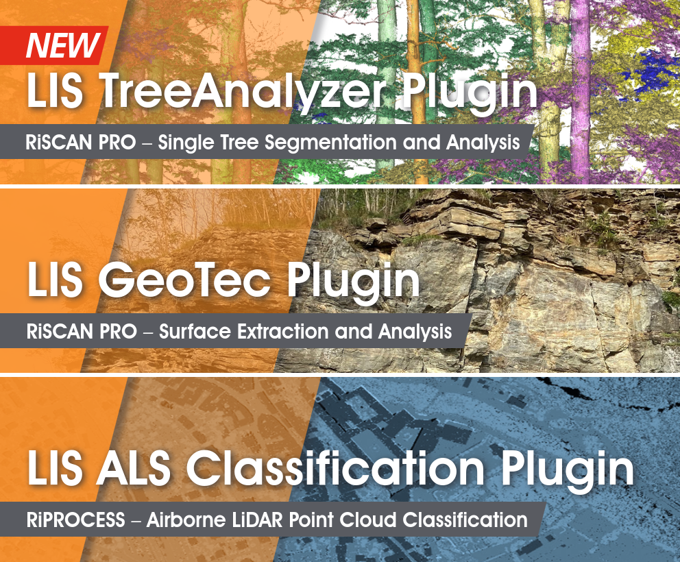
LIS Plug-ins for Riegl Software Packages
LASERDATA is developing software plug-in solutions for
the global laser scanner manufacturer RIEGL LMS GmbH based in Horn, Austria. These include the
classification of airborne laser scanning data, geological structural analyses or individual tree analyses
from terrestrial laser scanning data.
For more information, please visit the LIS Pro 3D homepage.
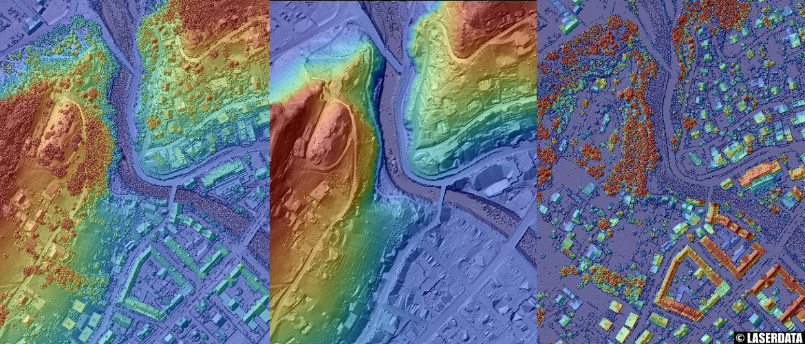
Raster derivatives (DTM, DSM, nDSM) from ALS point cloud data
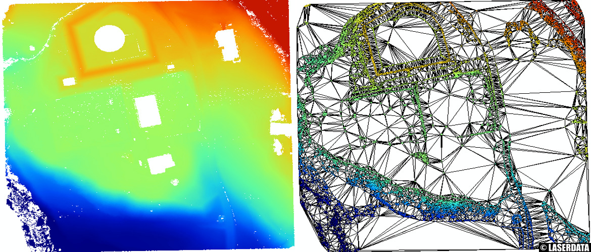
ALS point cloud thinning by surface roughness and derived TIN model
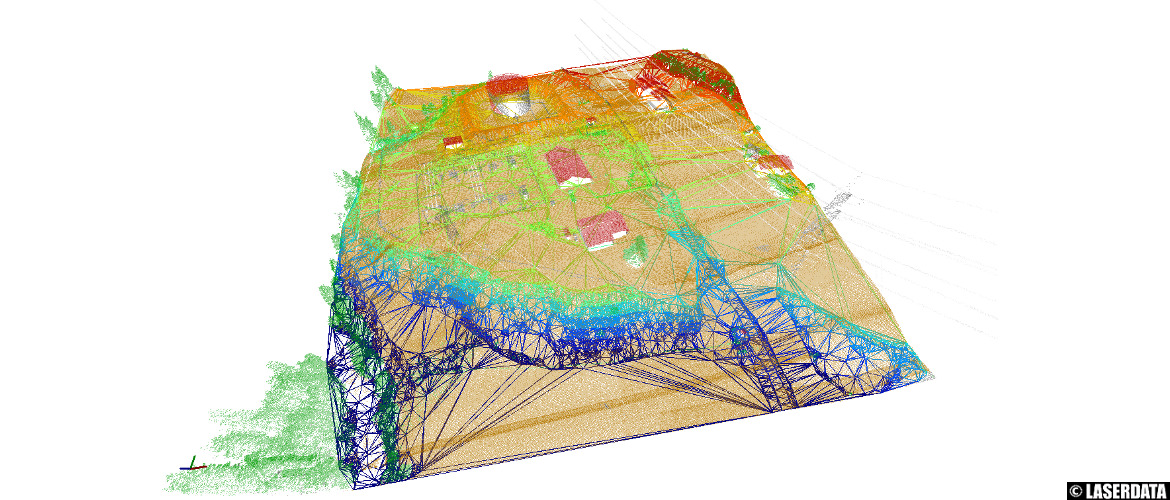
ALS point cloud thinning by surface roughness and derived TIN model (3D Viewer)
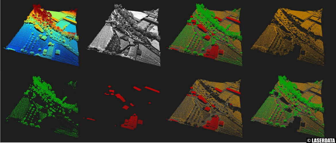
Shortcut visualization options in the 3D point cloud viewer
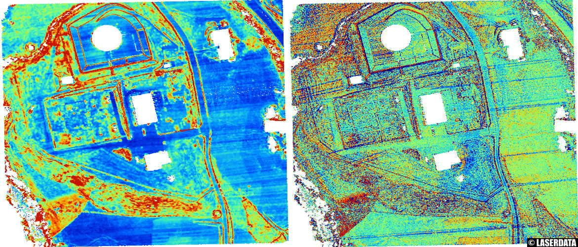
Measures of surface roughness derived from ALS point cloud data
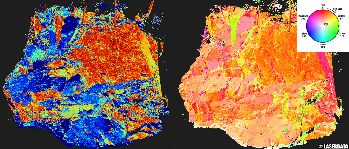
Structural geology: dip and dip direction from TLS point cloud data
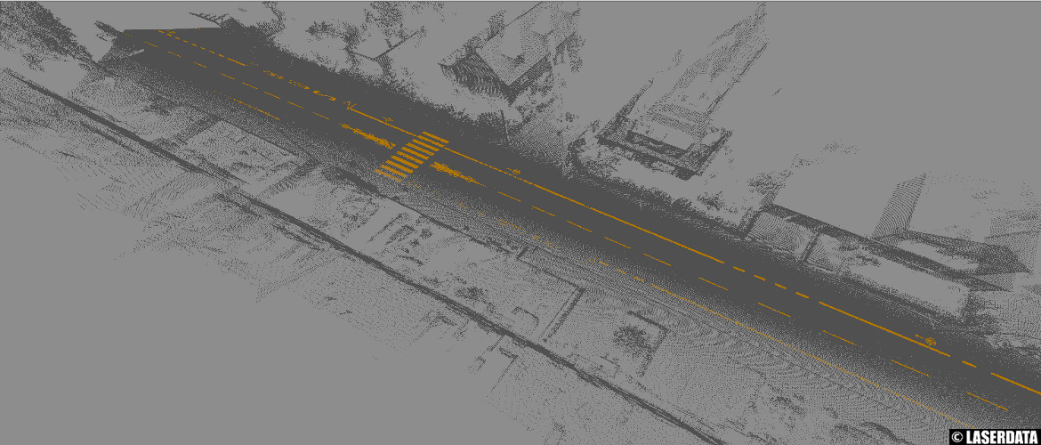
Extraction of road markings from MLS point cloud data
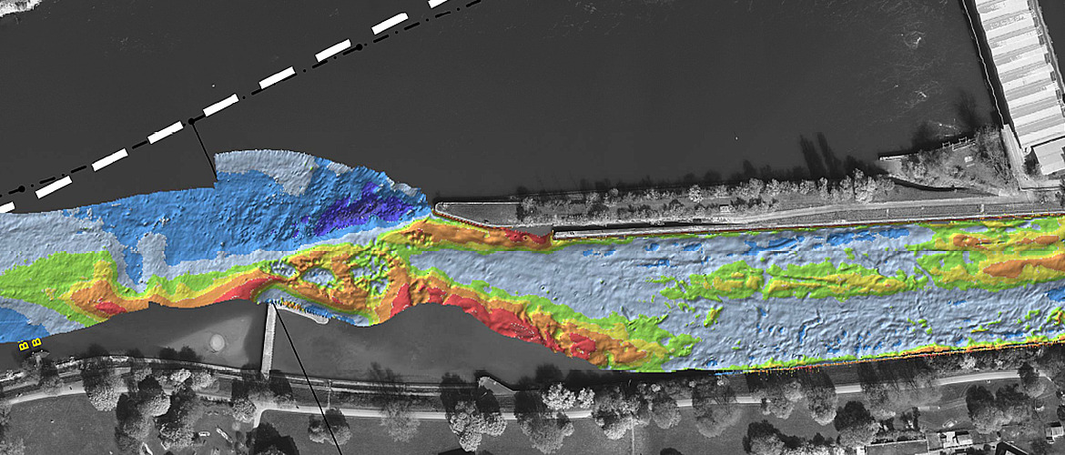
Ground extraction from bathymetric point cloud data (multibeam echosounder)
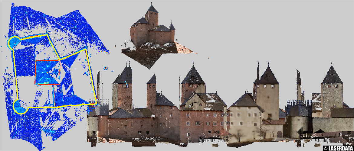
Point cloud unwinding and orthoimage creation
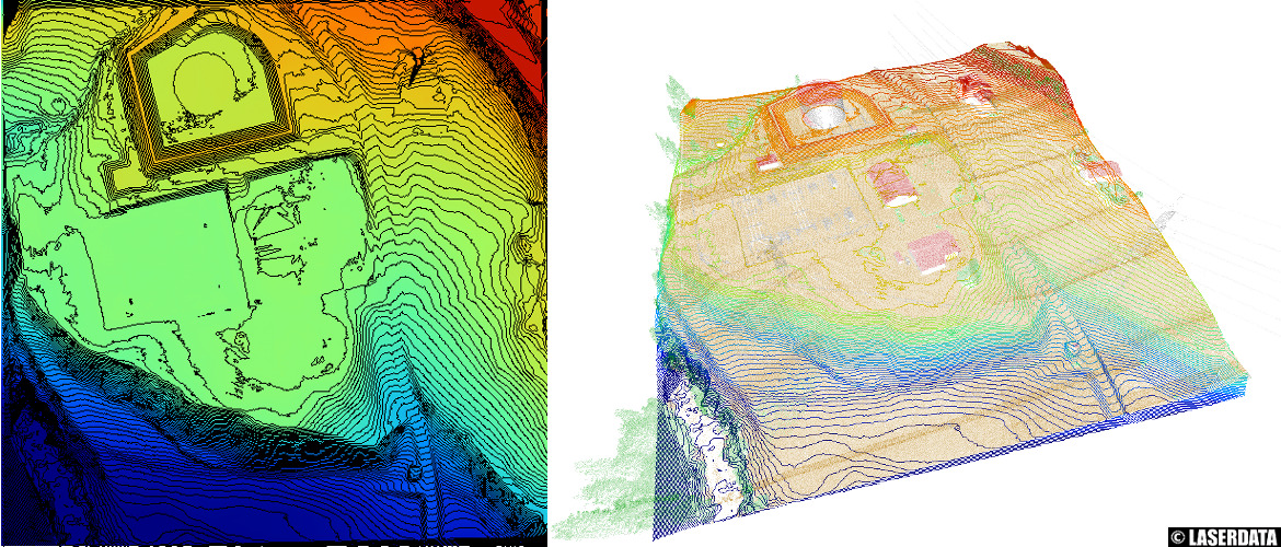
Derivation of 3D contour lines
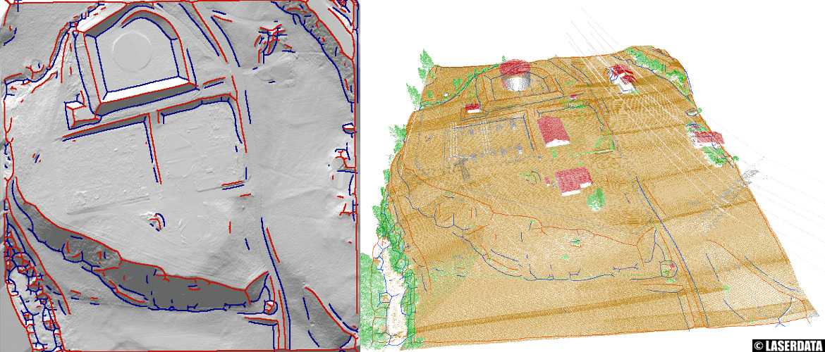
Derivation of 3D breaklines

SAGA - System for Automated Geoscientific Analyses
The System for Automated Geoscientific Analyses (SAGA) is a well known free and open source GIS, providing a comprehensive
set of processing tools for raster and vector data. We are contributing to the project on different levels being
part of the SAGA GIS development team, maintainer of the project web page and user forums, and funding member of
the SAGA User Group Association.
We provide professional services for SAGA, including consultancy, automation (scripting) and tool development.
Most of the project resources are hosted on sourceforge,
including binaries, source code, documentation/tutorials, user forums, wiki and bug tracker. Besides that,
additional information like references (documentation, research papers, API reference, tool reference) can be
found on the project's homepage.